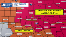
Relentless heat continues in North Texas. Heat Advisories and Excessive Heat Warnings remain in effect.
High temperatures will stay above 100 degrees for the rest of the week. During the month of August, seven days reached record-high levels.
Record-breaking heat is possible again as we head towards the weekend.
Get DFW local news, weather forecasts and entertainment stories to your inbox. Sign up for NBC DFW newsletters.
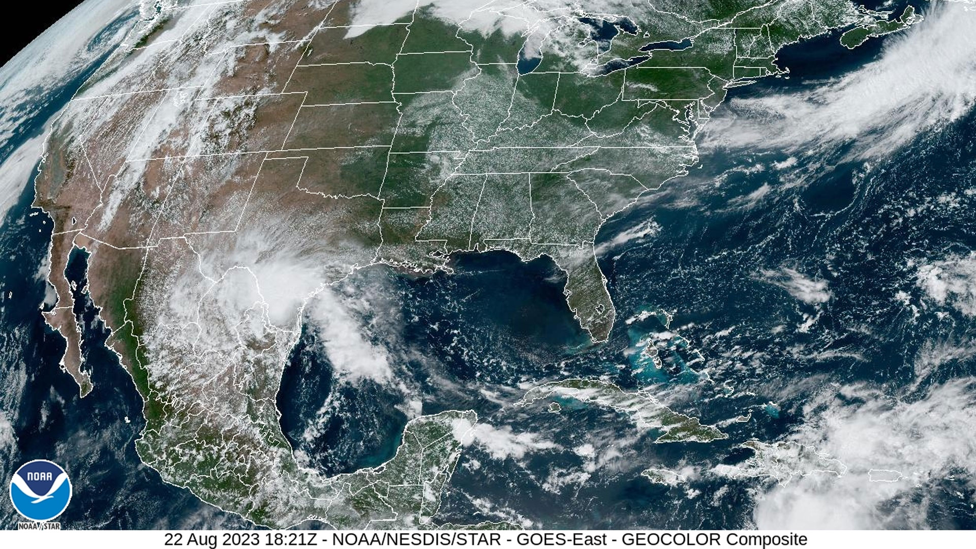
In August or September, it is not uncommon for tropical storms to bring heat relief and rain after a hot, dry stretch of summer weather. Tropical Storm Harold, however, will not bring the much-anticipated relief to North Texas.
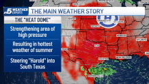
The heat dome, a broad area of high pressure, will strengthen bringing even hotter weather to North Texas and keeping the impacts of Harold to our south.
North Texas may see an increase in high clouds due to the tropical storm, but no rain.
The official forecast issued by the National Hurricane Center keeps the track west/ northwest into Mexico.
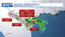
Residents in South Texas will receive about 3-5 inches of rain. Winds will be around 30-50 mph. Flash flooding will be possible, but most of the severe impacts will be felt in Northern Mexico with higher rainfall totals. Storm surge will be minimal.
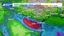
This is welcome rain for the southern part of the state. For the 9th consecutive week drought conditions in the state of Texas have been intensifying.
While Harold will not be a drought buster, it will certainly help.
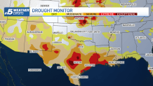
Parts of the Hill Country and Austin are experiencing the worst drought conditions in the state, these areas will receive little to no rain this week. North Texas will also stay dry for the remainder of the week.