

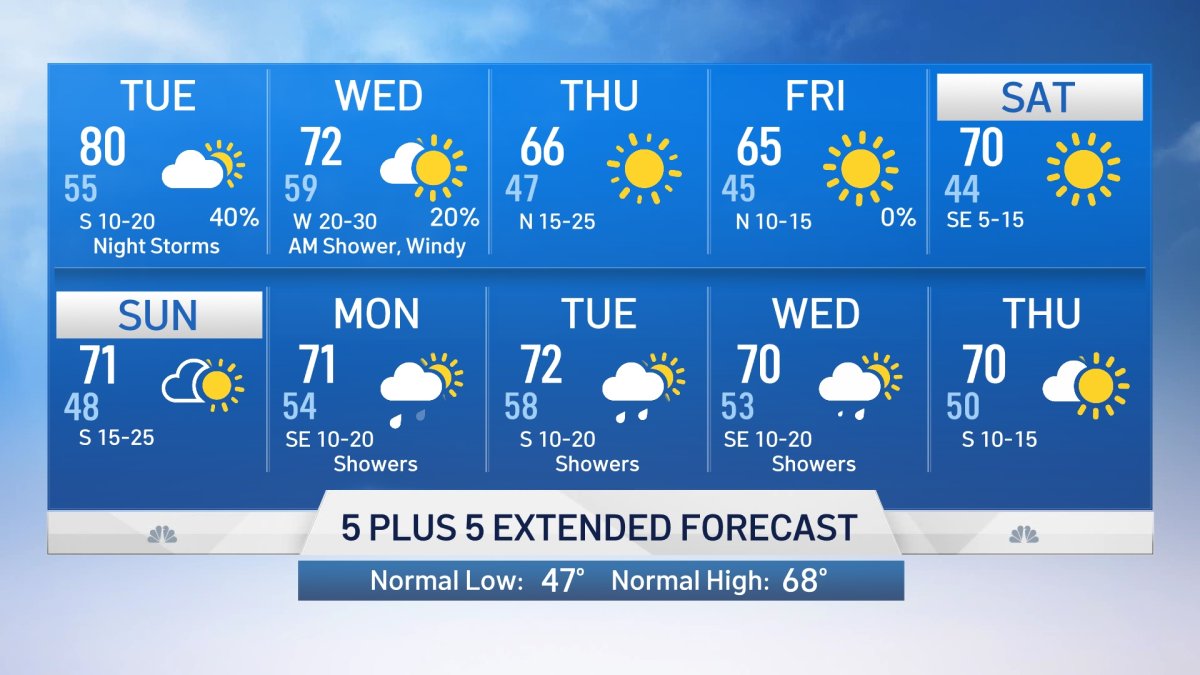
Dry and warm weather will continue into Tuesday with highs in the upper 70s to around 80. The normal high temperature for mid March is in the upper 60s.
Severe weather season is here and our next round of storms could turn severe.
A strong storm system and associated cold front will move through North Texas starting Tuesday. A line of storms will develop Tuesday evening-night to our west and move east through Wednesday morning.

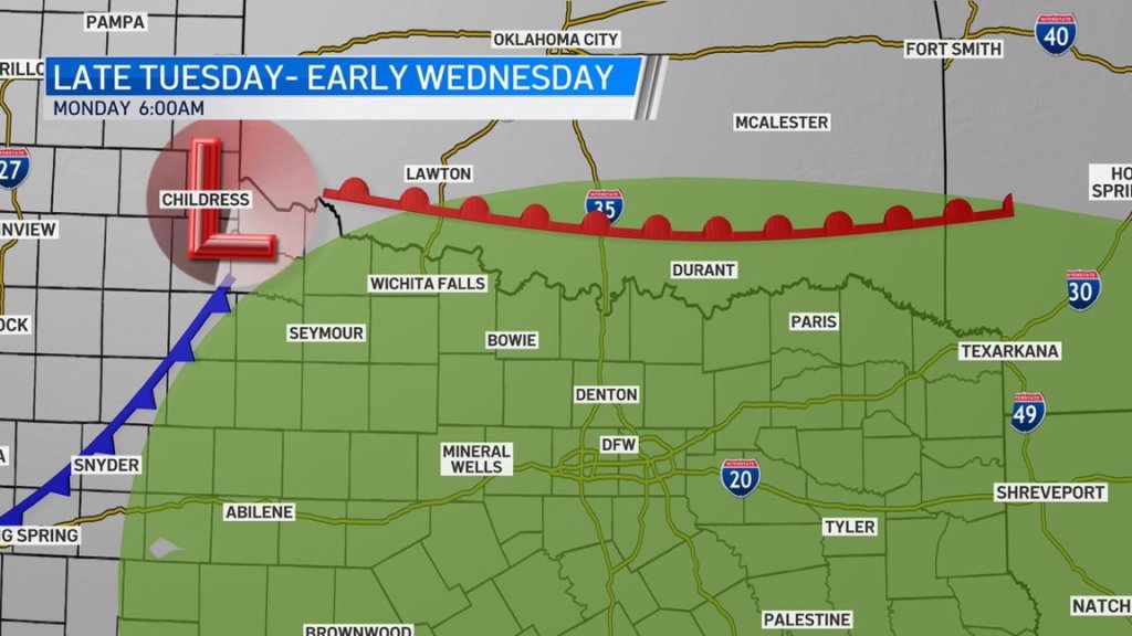
All storms exit North Texas by early Wednesday afternoon.
Get DFW local news, weather forecasts and entertainment stories to your inbox. Sign up for NBC DFW newsletters.
Most of North Texas has been placed under a marginal risk for severe storms. Areas northeast along the Red River have a slight risk.
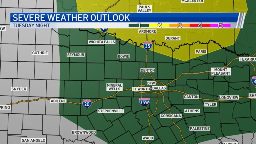
Stronger storms will be capable of producing hail and winds in excess of 60 miles per hour.
Local
The latest news from around North Texas.


The remainder of the week will be dry.
Read the latest forecast here.
CONTINUING WEATHER COVERAGE
Stay up to date with the latest weather forecast from NBC 5's team of Weather Experts by clicking here or by watching the video below.