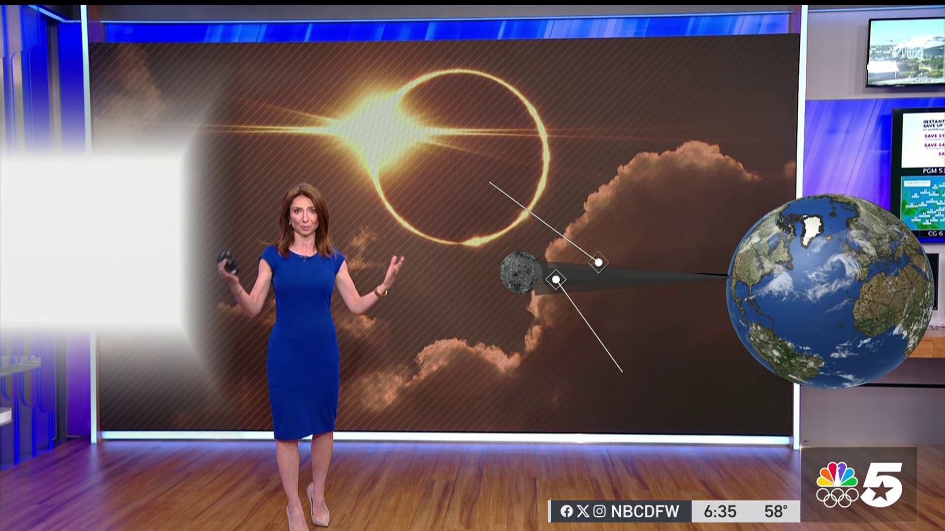
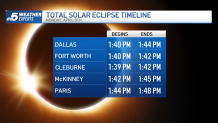
Today is the day! Eclipse day is finally here!
High clouds are already starting to stream into North Texas this morning. There is still a concern for an area of thick low stratus clouds to develop for locations along and south of I-20. Areas north of I-20 will see some scattering around eclipse time, allowing for some viewing. Right now the best viewing possibility for North Texas looks to be for areas north of Highway 380. For more on how clouds can impact the solar eclipse, click here.
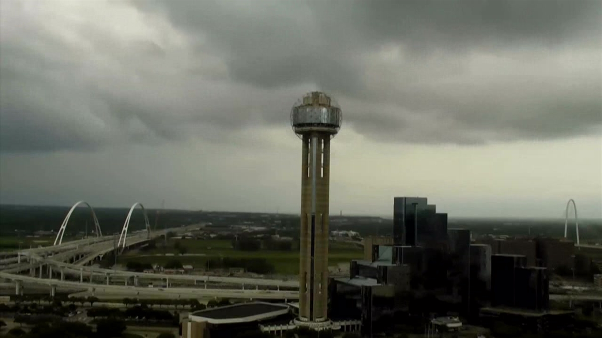
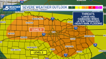
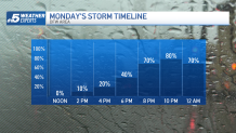
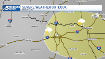
Showers and thunderstorms are expected to develop late Monday afternoon and evening, after the eclipse. All modes of severe weather will be possible with large hail, high winds, and even a few tornadoes. Rounds of heavy rain could also create flooding problems through early next week. This could cause trouble for those travelling home after the eclipse.
Get DFW local news, weather forecasts and entertainment stories to your inbox. Sign up for NBC DFW newsletters.
Previous Discussions
Saturday, April 6th - High clouds will start to stream into North Texas late Sunday night into Monday morning. These high clouds may start off fairly thin early in the day but should thicken as we approach the midday and afternoon.
Confidence is increasing that we`ll have some low clouds in place early Monday morning across our southeast counties that could spread north leading up to the eclipse. For more on how clouds can impact the solar eclipse, click here.
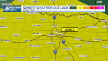
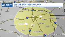
Showers and thunderstorms are expected to develop late Monday afternoon and evening, after the eclipse. The Storm Prediction Center has placed much of North Texas in a level 2 threat. All modes of severe weather will be possible with hail, high winds, and even a tornado or two as concerns. Rounds of heavy rain could also create flooding problems through early next week.
Friday, April 5th - High clouds will start to stream into North Texas by Monday morning. High clouds can obscure the sun somewhat, diminishing the viewing experience. However, a veil of high clouds is often thin and transparent enough that some viewing will still be possible.
The forecast for low clouds is more uncertain. With a moisture rich airmass to our southeast, these clouds could drift close to North Texas by eclipse time.
Showers and thunderstorms are expected to develop late Monday afternoon and evening, after the eclipse. All modes of severe weather will be possible with hail, high winds, and even a tornado or two as concerns. Rounds of heavy rain could also create flooding problems through early next week.
Thursday, April 4th - The forecast continues to fluctuate. High clouds are still likely but ahead of an approaching weather system low clouds and moisture will spread into North Texas from the south. The timing of these low clouds is critical. If they move in later in the day then there would be breaks in the clouds. If they move in quickly, we risk low clouds blocking the view of the eclipse.
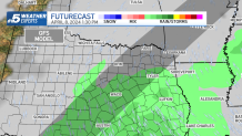
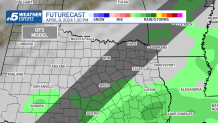
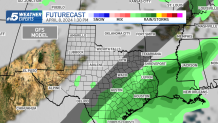
Forecast models we are watching show clouds during the time of totality with rain staying south or southeast of the DFW area.
Severe weather is also looking likely Monday. Timing of storms should be well after eclipse, Monday night into Tuesday morning. The Storm Prediction Center has highlighted us in a risk area.
Wednesday, April 3 - The chance for rain and low thick clouds during the time of totality is decreasing-- meaning the chance for a glimpse of the eclipse is increasing. High clouds look likely and this is better scenario than low clouds because they are thinner and there could be breaks in the clouds.
Rain looks to stay south and east of the DFW area during the time of totality.
Tuesday, April 2nd - The forecast looks a little more optimistic today. We enter an active weather pattern starting Sunday as a series of disturbances move through North Texas. While that does mean a good chance for rain and cloud cover, depending on timing there will be breaks in the clouds and rain between disturbances.
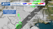
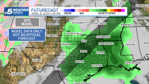
The GFS model shows clouds over DFW Monday afternoon with rain to the east.
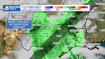
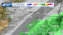
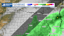
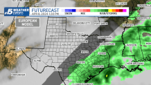
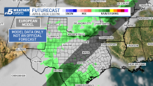
The European Model is showing a similar scenario this morning. Clouds overhead with rain to our east.
This far out models broad-brush the cloud cover. As we get closer to Monday higher resolution models will be able to see if there will be breaks in the clouds.
The National Weather Service is giving our area a 20-25% chance for favorable viewing conditions. There is a lot to watch in the coming days. Stay tuned.
Monday, April 1st - The long-range models are hinting that an active pattern will be setting up. Not only could this mean added cloud cover but also the potential for showers and thunderstorms.
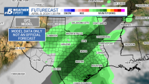
The GFS (American Model) on Monday continues to show clouds and rain during the time of totality.
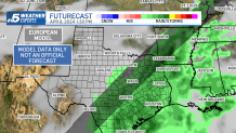
The European Model is trending wetter. Today it shows spotty showers and clouds over the Dallas/ Ft. Worth area.
Sunday March 31st - Today's GFS (American Model) is suggesting an area of rain pushing through much of the Lonestar State during eclipse time.
Meanwhile, the European Model is showing drier conditions for the path of totality but extensive cloud cover.
This far out, models aren't very skillful at forecasting cloud cover for a single hour. As the big day approaches, the forecast will become more in focus. Make sure you continue to check back for updates!
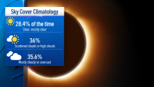
Clouds aren’t out of the ordinary for early April across North Texas. Typically, April 8th has a 35.6% chance of mostly cloudy or overcast skies.
Saturday, March 30th - An unsettled pattern will set up late next weekend into early next week and could bring unfavorable eclipse viewing conditions. The GFS (American Model) is showing cloudy skies across much of the Lonestar state. The European Model is also painting a cloudy picture with rain.