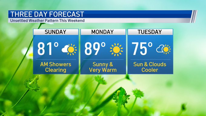

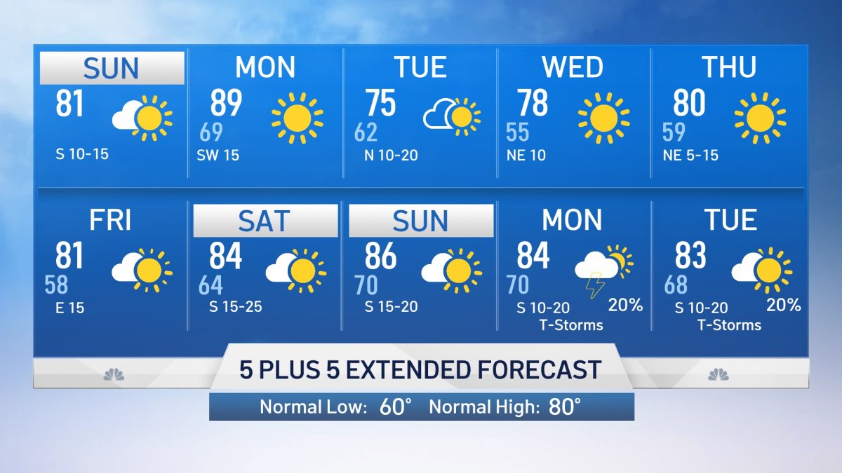
By late Sunday morning, the storm system responsible for the unsettled weather in North Texas will be moving east and weakening. Sunshine will return by Sunday afternoon with high temperatures in the low 80s.
Showers have ended in DFW Sunday, but will remain across eastern portions of the region through Sunday morning. Additional showers cannot be ruled out in East Texas this afternoon, but the rest of the region will be dry with clouds giving way to sunshine and highs in the 80s.
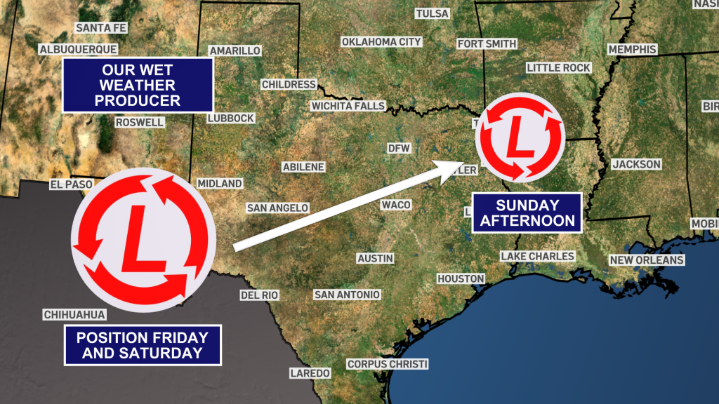
The rain is associated with an area of low pressure has weakened and moved northeast, and will finally exit the state by Sunday evening.

Get DFW local news, weather forecasts and entertainment stories to your inbox. Sign up for NBC DFW newsletters.
As this low moves to the northeast, drier air will move in on the back side of it, bringing an end to the last of the rain and thunderstorms, while allowing skies to clear out from southwest to northeast. High temperatures will be back to seasonal levels on Sunday. Monday is expected to be even warmer ahead of our next cold front.