


Hazy skies over Dallas on Wednesday were a result of smoke from brush fires in North Texas settling. NBC 5 Meteorologist Rick Mitchell explains the smoke inversion.
S Band Radar & Maps | Forecast | Weather Alerts
Traffic | Send Us a Photo/Video | Live Cams
Neat video from Texas SkyRanger Wednesday showed a thin layer of smoke hanging over the Dallas skyline.
The series of grassfires around North Texas on Monday produced quite a bit of smoke, but over the last couple of days high pressure has settled into the area.
The high pressure does two things. It reduces the wind speed and it helps to create an inversion -- a layer of warm air above the ground.
Here is a picture of this morning’s balloon sounding from the National Weather Service office in Fort Worth. The red line shows the temperature.

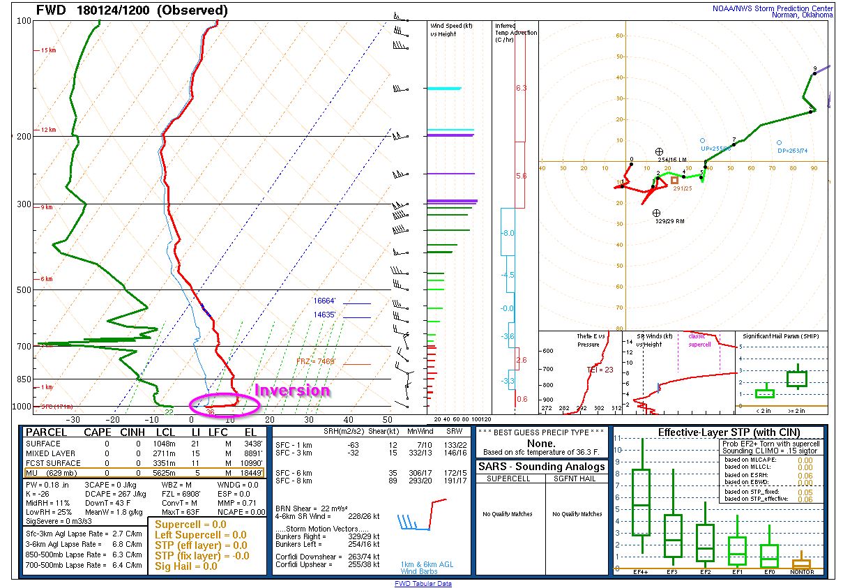
In normal conditions, the atmosphere cools the higher you go, but in an inversion the temperature warms up.
Local
The latest news from around North Texas.


Inversions most often set up during the late night through early morning hours.
That layer of warm air acts like a lid and prevented the smoke from completely clearing out of the sky.
Last night, as the temperature dropped down in the 30s and the wind became light, the inversion moved to an even lower part of the atmosphere.
That pushed the leftover smoke even lower into the atmosphere and also concentrated the smoke down close to the ground. That’s why it was so visible and made it look like a thin layer of clouds.
Get the latest forecast information from NBC 5's team of Weather Experts here.
 Interactive Radar |  NBC 5 S-Band |  Dallas County |  Tarrant County |
 Collin County |  Denton County |  Ellis, Johnson Co. |  Rainfall Totals |

