


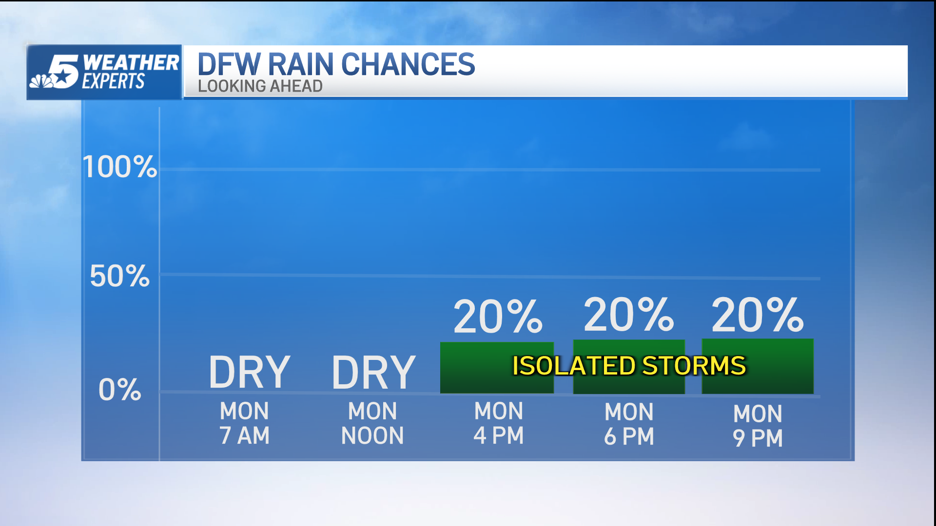
The temperature climbed into the low 90s Monday afternoon as sunshine and a strong southwesterly breeze combined to heat us up about 20 degrees above normal.
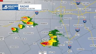
Isolated thunderstorms developed southwest of Fort Worth Monday evening, and some of them produced hail of golf ball and even baseball size. But no rain reached DFW.
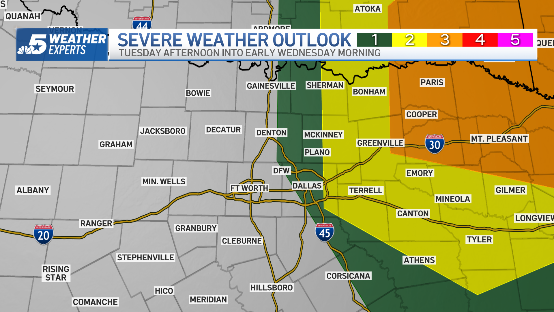
A better chance for storms will return late Tuesday into Tuesday night as a cold front draws near. This front will usher in cooler air for the second half of the week.
A few showers may return toward Easter weekend.
Get DFW local news, weather forecasts and entertainment stories to your inbox. Sign up for NBC DFW newsletters.

WEATHER PHOTOS
Local
The latest news from around North Texas.


Have a photo you'd like to share, upload it here or email it to iSee@nbcdfw.com.
This is the hail we received in the 76111 area.
McKinney
Sent from my iPhone
WHAT TO DO?
The NBC 5 Weather Experts will keep you updated, on-air and online, as this system moves in.


