What to Know
- Three people hurt when a tornado crossed Interstate 35E near Waxahachie
- Tornadoes confirmed in Blum, Forreston communities
- Damage, additional tornado reports to be surveyed by National Weather Service
At least two tornadoes are confirmed in North Texas Monday in a line of severe weather that followed the warmest temperatures of the year so far.
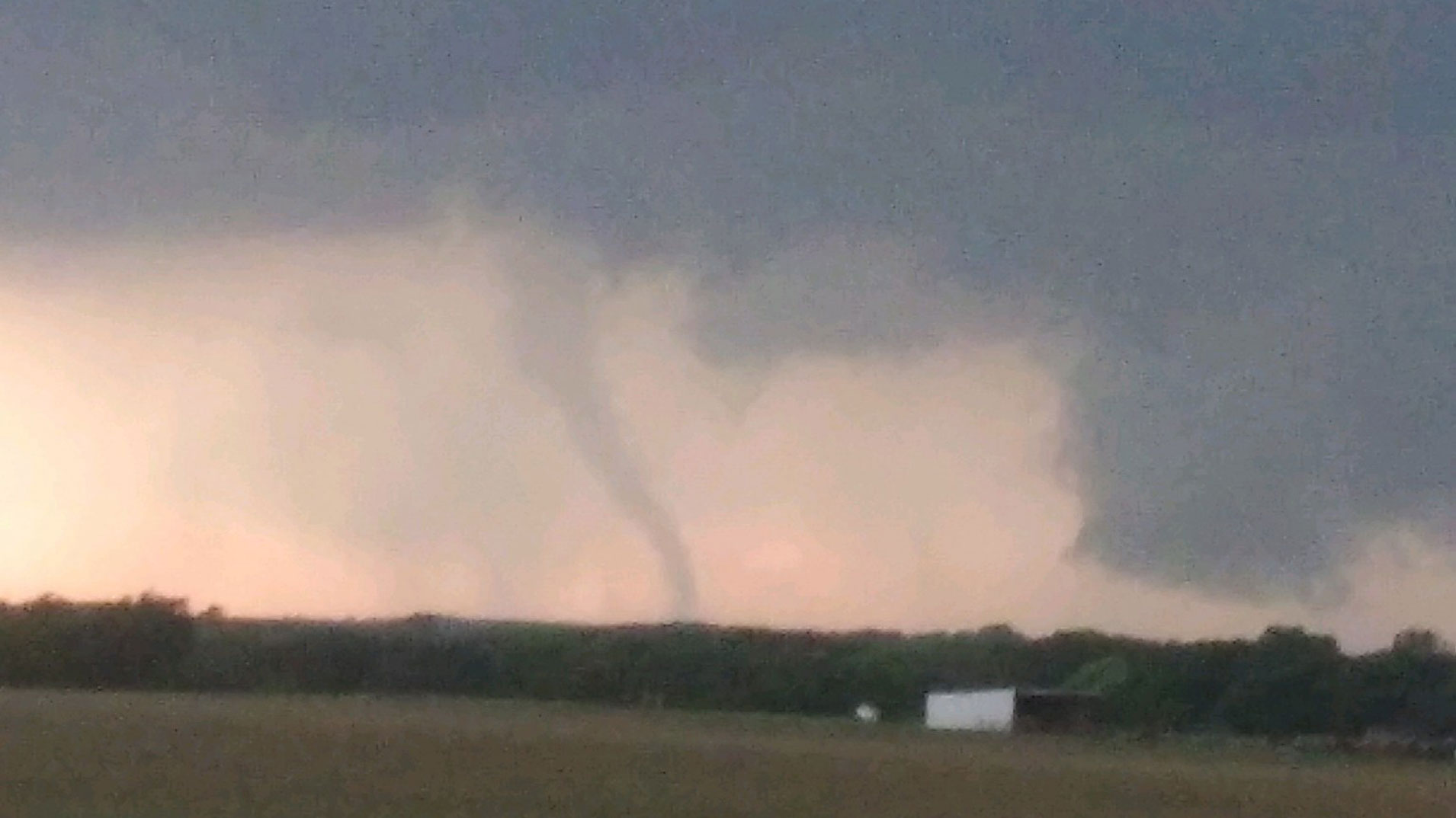
The NWS confirmed the tornado northwest of Blum was an EF-2 with 130 mph wind speeds.
A Tornado Watch for a large swath of the area was allowed to expire at 11 p.m. Monday while a Severe Thunderstorm Watch for much of North Texas ended by 3 a.m. Tuesday.
Get DFW local news, weather forecasts and entertainment stories to your inbox. Sign up for NBC DFW newsletters.
Thunderstorms began developing after 5 p.m. along the western portion of the Dallas-Fort Worth area and moved eastward throughout the evening.
A confirmed tornado was spotted along U.S. Highway 377 just east of Granbury at about 6 p.m. The National Weather Service also received reports of golf ball-sized hail near Granbury as storms developed.
Another tornado was spotted along the Johnson County-Hill County line at about 7:30 p.m.
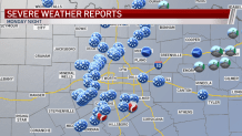
Damage was reported across the southern parts of North Texas, from Granbury to Waxahachie.
Video from Texas Sky Ranger showed extensive damage to buildings in the area between Waxahachie and Forreston -- the same area where a tornado crossed Interstate 35E and caused several 18-wheelers to crash, injuring three people.
Large hail and strong winds were also reported across North Texas.
Monday featured the hottest weather so far this year. Highs in North Texas were in the upper 80s and low 90s. Prior to Monday, the warmest temperatures this year happened on April 11 and 12, where the highs reached 87 degrees on both days.

The strong cold front that brought severe storms will bring relatively cooler, more seasonable weather for the rest of the week.
The rest of the workweek will feature mainly sunny skies with lower than normal humidity for early May. High temperatures will be in the 70s through Wednesday, then gradually warming back into the 80s by Thursday. A slight chance of storms returns this weekend.