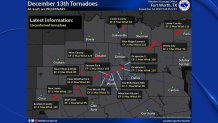
The National Weather Service says 16 tornadoes are confirmed to have touched down across North Texas as a potent December storm system swept through the region Tuesday morning.
The NWS said survey crews have been out looking at damage across North Texas in the days following the outbreak.
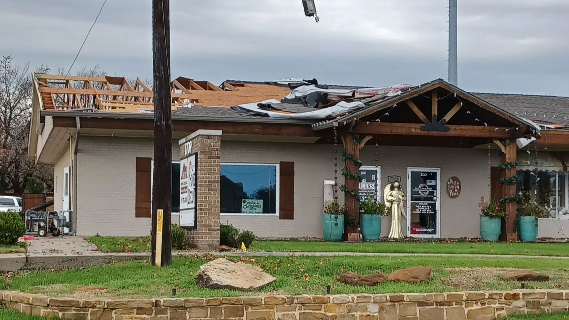
Of the confirmed tornadoes, six occurred across Tarrant County in areas around Naval Air Station Joint Reserve Base Fort Worth, North Richland Hills and in Grapevine where five people were hospitalized with injuries that were not life-threatening.
Get DFW local news, weather forecasts and entertainment stories to your inbox. Sign up for NBC DFW newsletters.
- Two of the three tornadoes that touched down near the joint reserve base were rated EF-0 while the third was an EF-1. The first, an EF-0, touched down near the air traffic control tower at 8:10 a.m. A minute later another EF-0 touched down near an aircraft hanger and continued toward the food court. The third, an EF1, touched down in nearby Marion Sansom Park and caused damage to trees. All of the tornadoes were spawned from the same parent storm but all lifted and reformed causing discontinuous damage. Each touchdown is counted as a separate tornado.
- In Grapevine, two EF-1 tornado tracks were confirmed -- a longer track through most of Grapevine with 110 mph winds and a separate short track over Grapevine Mills Mall with 100 mph winds.
- In North Richland Hills, the NWS said an EF-1 tornado with max winds of 90 mph left a track 1.5 miles long.
- An EF-2 tornado was confirmed in Wise County where at least two homes were destroyed by winds reaching 125 mph.
- An EF-2 with max winds of 115 mph, was confirmed west of Paris in Lamar County. That tornado tracked from near Petty to Hopewell.
- An EF-0 was confirmed in Cooke County near Callisburg.
- In southeast Palo Pinto County, south of Santo, an NWS survey team confirmed an EF-1 tornado touched down Tuesday with maximum winds of 110 mph.
- An EF-2 tornado with maximum winds of 135 mph was confirmed south of Ranger in Eastland County.
- An EF-2 tornado brought winds up to 125 mph along a track from Blue Ridge in Collin County to Leonard in Fannin County.
- An EF-1 with max winds of 90 mph was confirmed near Wolfe City in northern Hunt County.
- An EF-0 with max winds of 85 mph was confirmed in Parker County, where it briefly tracked on the southwest side of Greenwood, southwest of Weatherford.
- An EF-0 with max winds of 80 mph affected western Parker County where tree damage was noted.
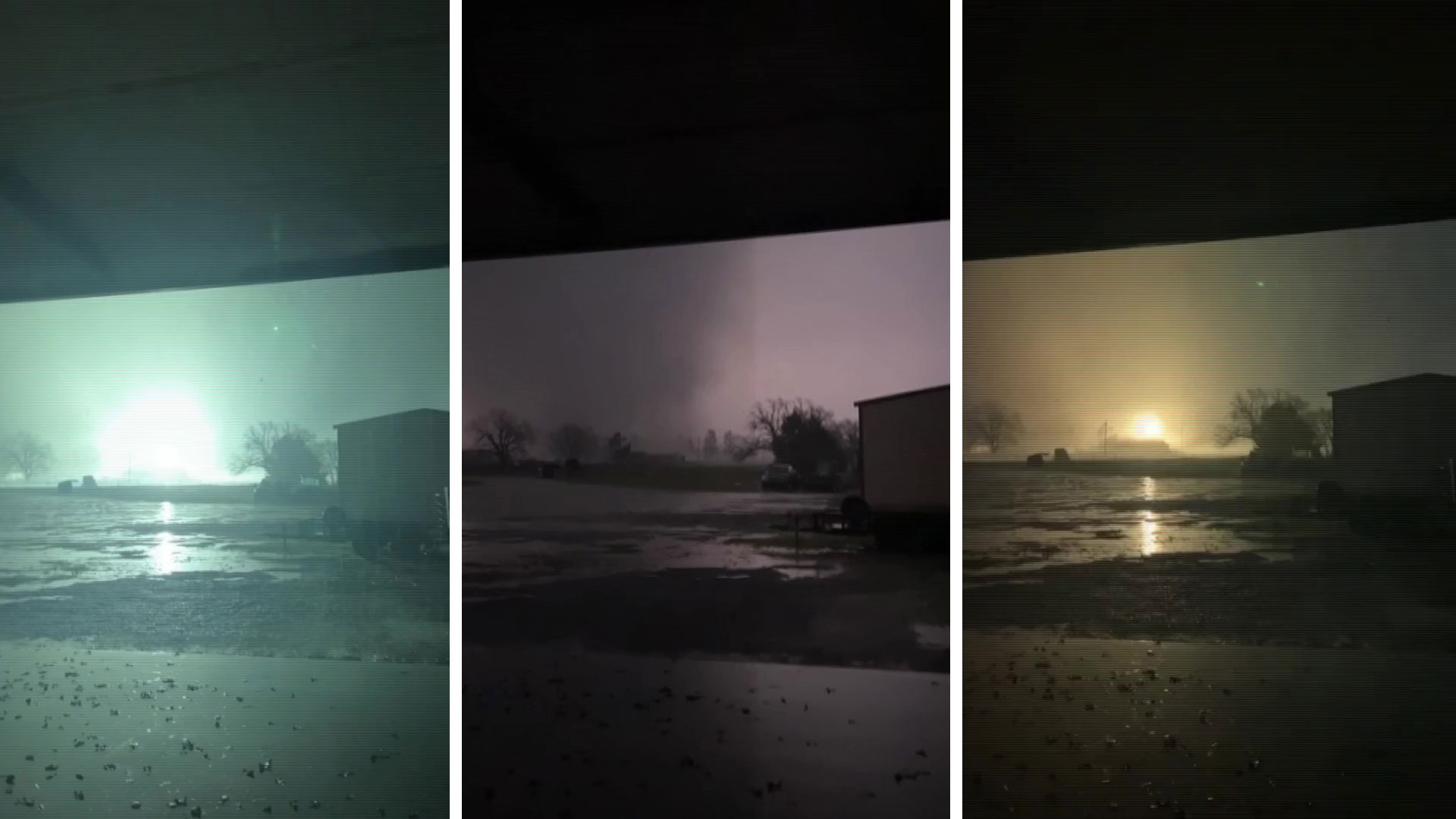
Photos of Storms That Produced Tornadoes on Dec. 13, 2022
TORNADO WARNING HISTORY FOR DEC. 13, 2022
- The first Tornado Warning of the day was issued in Jacksboro and Vinyard at 5:09 a.m. as severe thunderstorms moved northeast across North Texas Tuesday morning. At 5:31 a.m., a Tornado Warning was issued in Palo Pinto County for Mineral Wells and Cool as the storms pushed east.
- Four minutes later, at 5:35 a.m., another Tornado Warning was issued for Huckabay. At 5:58 a.m. the NWS urged anyone in the path of the tornado warned storm in Eastland and Erath counties to seek shelter.
- At 6:09 a.m. the fourth Tornado Warning was issued, this time for De Leon, Duster and Rucker in Comanche County.
- At 6:13 a.m. a Tornado Warning was issued for Parker and Wise counties including Springtown, Paradise and Agnes. At 6:36 a.m., as the storms pushed northeast, the sixth warning of the morning was issued and included Weatherford, Willow Park and Hudson Oaks.
- Just before 7 a.m. a Tornado Warning was issued for Decatur, Krum and Ponder and included a shelter warning.
- At 7:21 a.m., a Tornado Warning was issued for Slidell in Wise County and at 7:32 a.m. a Tornado Warning was issued in Cooke and Grayson counties including Gainesville, Preston and Sherwood Shores. Just two minutes later, a Tornado Warning was also issued in Hood County for Granbury, Pecan Plantation and Oak Trail Shores.
- Severe storms began pushing into the Metroplex at about 7:30 a.m., with the first Tornado Warning in Tarrant County being issued at 7:35 a.m. for Keller, Saginaw and Azle. The NWS said at 7:40 a.m. that the storm, with embedded tornadic circulations, continued pushing northeast.
- At 8:11 a.m. Tornado Warnings were issued in Fort Worth, Arlington and North Richland Hills. NWS said four minutes later that a radar-confirmed tornado was spotted with debris in Sansom Park and River Oaks, moving northeast.
- At 8:17 a.m. the storm continued moving through Tarrant County and people in Saginaw, Blue Mound, Haltom City, and North Fort Worth were all warned to take shelter.
- At 8:48 a.m. a Tornado Warning was issued for Tarrant and Denton counties that included Grapevine, Flower Mound and Lewisville. Video reports later showed a tornado crossing Texas 114 near Texas 26 and there were several reports of damaged businesses, homes and vehicles.
- As the storm moved northeast toward Collin County, a Tornado Warning was issued at 9:12 a.m. for McKinney, Frisco and Allen with the NWS tracking the storm along Texas 121 from South Frisco to North Plano.
- As the line of storms moved into East Texas, a Tornado Warning was issued for Fannin County including Bonham, Leonard and Honey Grove at 10:06 a.m. At 10:20 a.m. the warning was expanded to include Honey grove, Roxton and Ladonia.
- In Lamar County, a Tornado Warning was issued at 10:52 a.m. for Toco and along the Red River for Arthur City and Powderly.
CONTINUING WEATHER COVERAGE
Stay up to date with the latest weather forecast from NBC 5's team of Weather Experts by clicking here or by watching the video below.

Be prepared for your day and week ahead. Sign up for our weather newsletter.