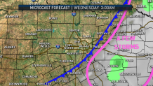
It feels like spring Tuesday morning; temperatures are in the 70s with dew points in 60s; southerly winds are pumping in gulf moisture. There is also a chance for severe storms this afternoon.
Despite a marginal risk for severe storms, the chance of an actual storm developing is lower. The reason: a strong cap is in place.
Southwest winds aloft are pumping in warm air to the upper levels of the atmosphere. Warm air above the surface prevents storm development. This is what we referred to as a "cap."
A cap prevents storms because as a parcel of air rises it becomes cooler than the surrounding air. The cooler parcels of air can then no longer rise, inhibiting thunderstorm development.
The air is still very unstable, so if a parcel of air can break through the cap, the storm would quickly grow severe. Our biggest risk would again be for large hail.
This morning the cap is strong so we do not expect storms.

This afternoon the cap weakens slightly to the east. A few storms may break through the cap. If they do they will turn severe.

Tuesday night the change for storms is greater. A cold front will erode the cap and storms may break out along the leading edge of the front.


